Delhi Master Plan 2047: Metro-Zone FAR Rises to 400 as DDA Colonies Get Redevelopment Rights
Government releases the complete Delhi Master Plan 2047 Massive changes: 70 villages opened for development, FAR increase, Yamuna floodplain rules relaxed, old DDA flats get new redevelopment norms & more 535 pages, We read all of it.
 Gaurav Gupta11 min read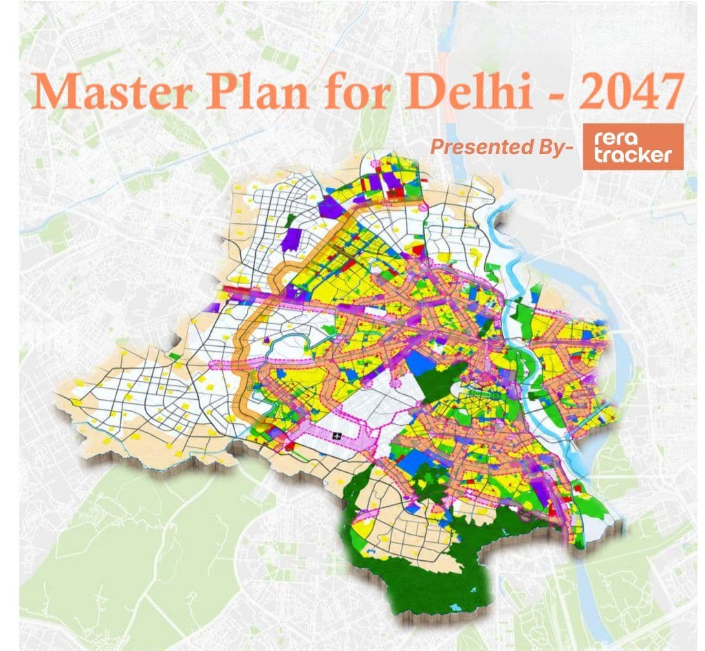
Why the need for this masterplan?
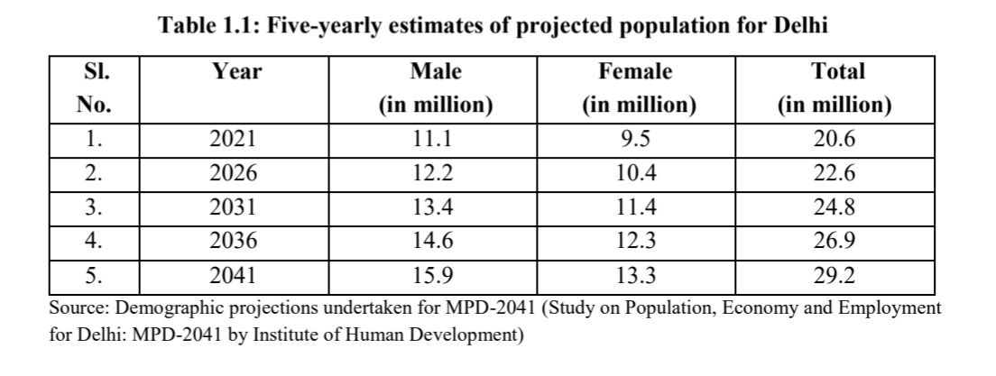
Delhi has 2.6 crore people today. By 2047 the plan expects 3.2 crore. That is 80 lakh more people.
Roughly the entire population of Bangalore, arriving into a city that cannot get any bigger.
And it genuinely cannot. Delhi is 1,483 sq km, hemmed in by Haryana and UP on every side. There is no empty land left at the edges to spill into. The number has not changed in decades and it will not change.
So the city has only one option. Build taller on the land it already has.
The Metro FAR zone: the single biggest lever
Now the biggest change in the document and the one that will decide where Delhi's money moves next.
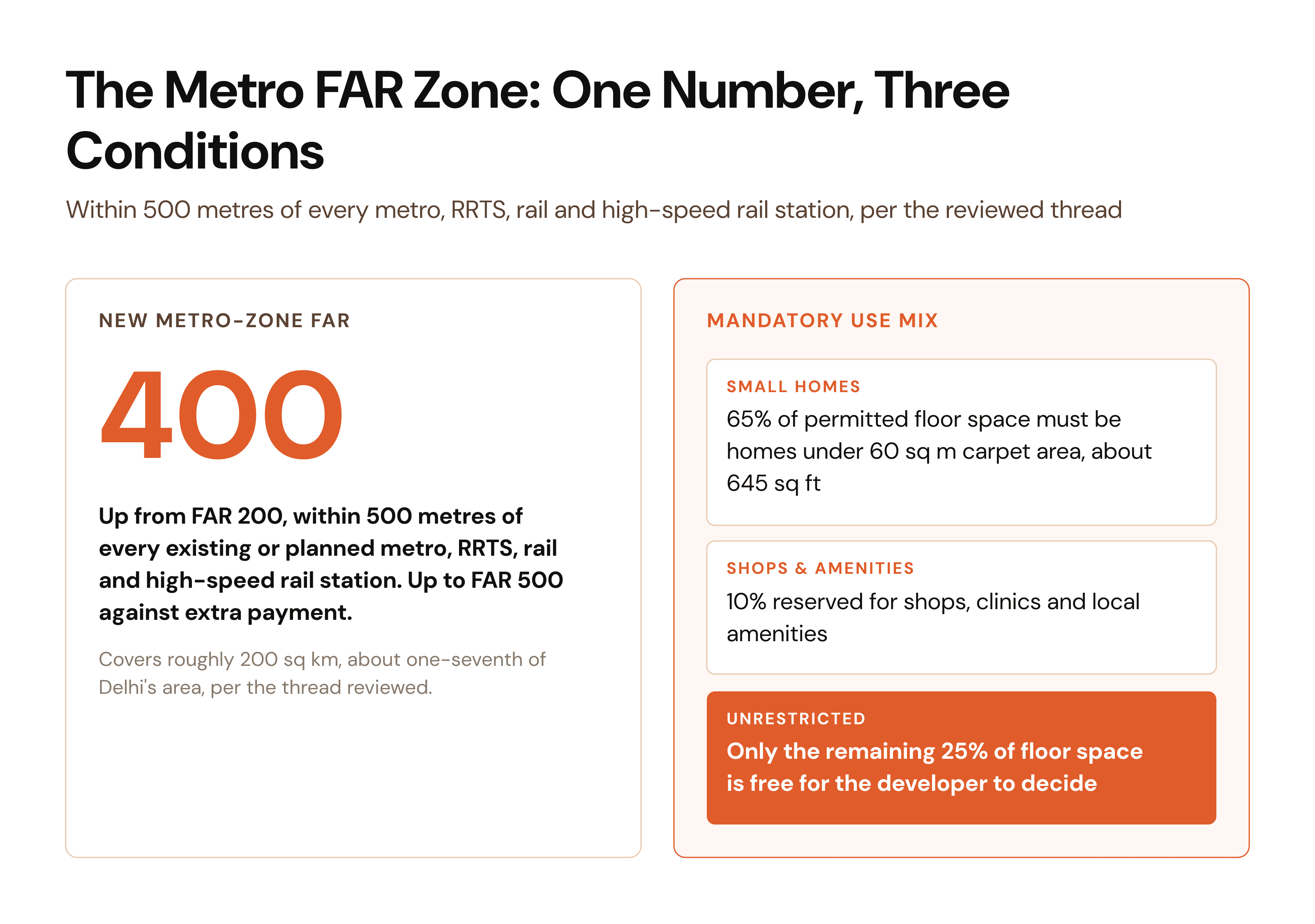
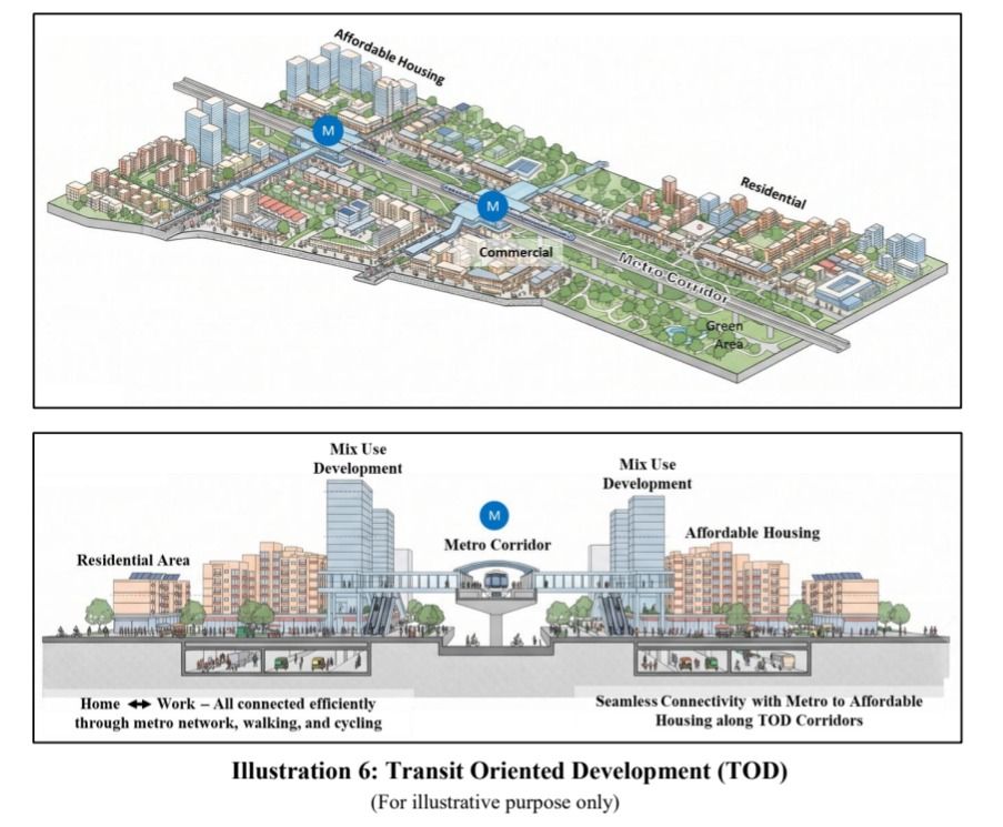
Take any Metro station in Delhi. Draw a 500 metre circle around it. Do that for every station, existing and planned, plus every RRTS and railway and high-speed rail station.
Add all those circles up and you get roughly 200 sq km. About one seventh of Delhi.
Inside those circles, the FAR goes from 200 to 400.
Allowed up to 500 if you pay more!
In plain terms: land within a 6 minute walk of a Metro station can now hold twice as many flats as it could last month.
If you own that land, you just got a lot richer. If you were planning to buy it, you are already too late.
But the builder does not get to decide what he builds there.
Of the permitted floor space inside a Metro zone:
65% must be homes under 60 Sqmt carpet area, roughly 645 square feet.
10% must be shops, clinics and local amenities.
Only the last 25% is free.
So the best located land in Delhi is legally reserved for small homes. It sits on page 99 and almost nobody has reported it.
Join our Delhi Real Estate Community
If you have followed this far that means you take keen interest in Delhi's Real Estate...
👇Join our Delhi Real Estate Community to stay updated on every relevant news on Delhi's Real Estate 👇 https://chat.whatsapp.com/IhjSxgFaYELJCxVpmXHgCR
Leasehold-to-freehold conversion near metro stations
A quieter clause, but for some people it is worth more than everything else in the plan.
A lot of property in Delhi is leasehold. You do not really own it. You have it on a long lease from the government, and every time you sell, mortgage or transfer it, you need permission and you pay fees.
Freehold means you own it outright.
The plan says: if leasehold plots get combined into a single project near a Metro station, they become freehold. Just clear your dues.
For families who have been sitting on leasehold land for generations, a paragraph in a planning document just converted it into a proper asset.
Ageing DDA and CGHS colonies: a path to knock down and rebuild
Now the part that affects the most people, Your 1970s DDA colony can be knocked down and rebuilt 50% bigger.
Half of Delhi lives in Ageing DDA flats, CGHS societies, government housing. DDA flats from the seventies. CGHS societies. Four storey blocks with cracked plaster, no lifts, parking chaos and pipes that were laid before most residents were born.
Key Criteria:
-
Minimum 3,000 Sqmt for residential, 1,000 Sqmt for commercial, industrial and institutional.
-
Societies and RWAs drive it. Detailed regulations only come after notification.
-
Maximum FAR in this case 1.5 times the base FAR
-
Amalgamtion and reconstitution of plots shall be permitted
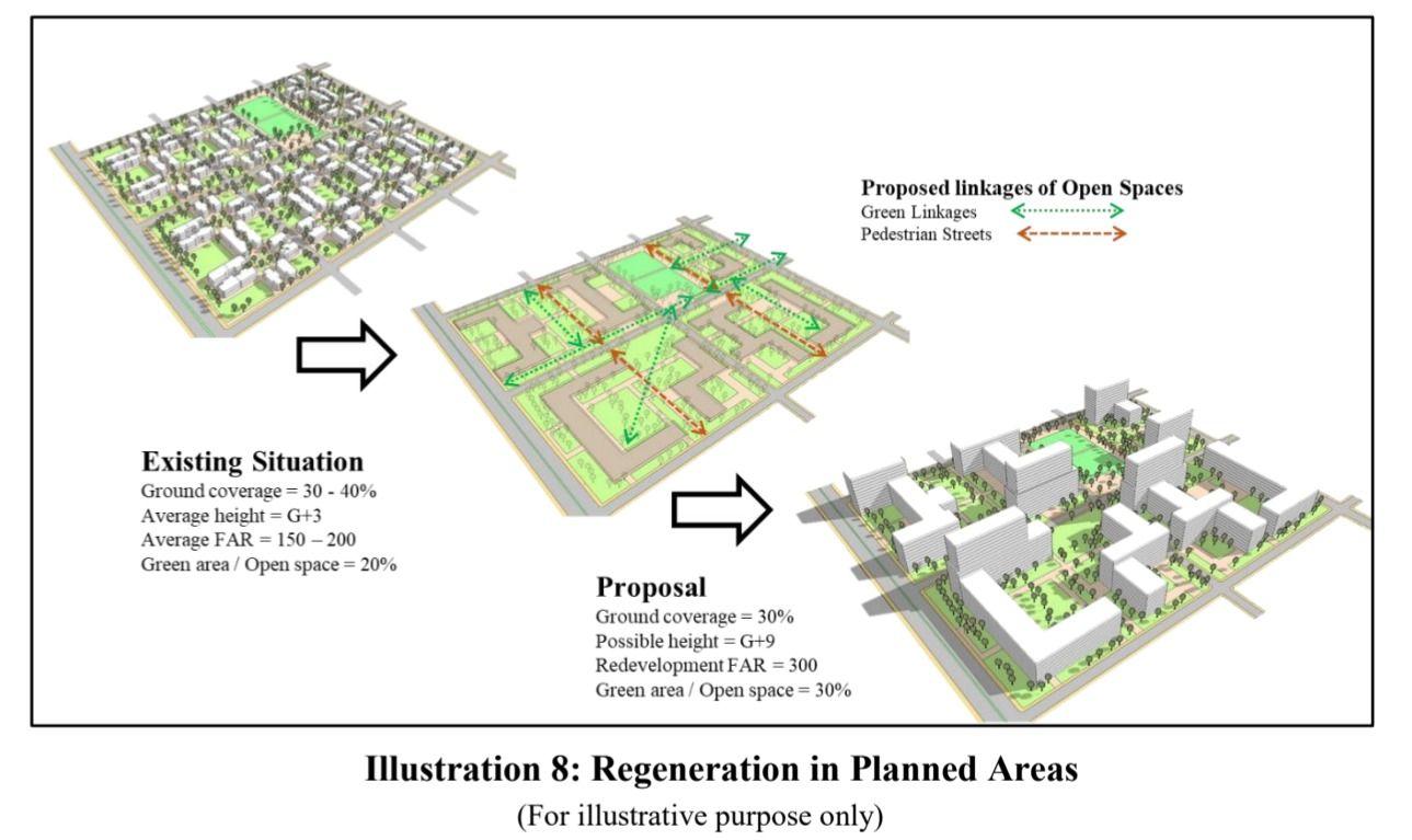
The plan lets these societies knock the whole thing down and rebuild at 1.5 times the current FAR. (regeneration)
Same land. Fifty percent more floor space. Which means the extra flats can be sold to pay for the rebuild.
If you live in an ageing colony in Delhi, this is the clause to read.
Slum and JJ cluster land gets the most generous FAR in the plan
Slum land now carries the most generous permission in Delhi!
Delhi has hundreds of slums and JJ clusters sitting on land that is now worth a fortune. Every plan for forty years has promised to fix this. None have.
Here is the new attempt, and it is at least mathematically serious.
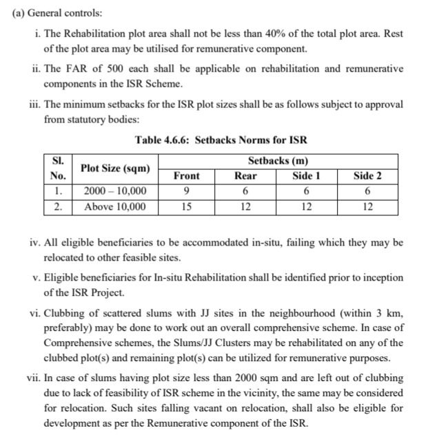
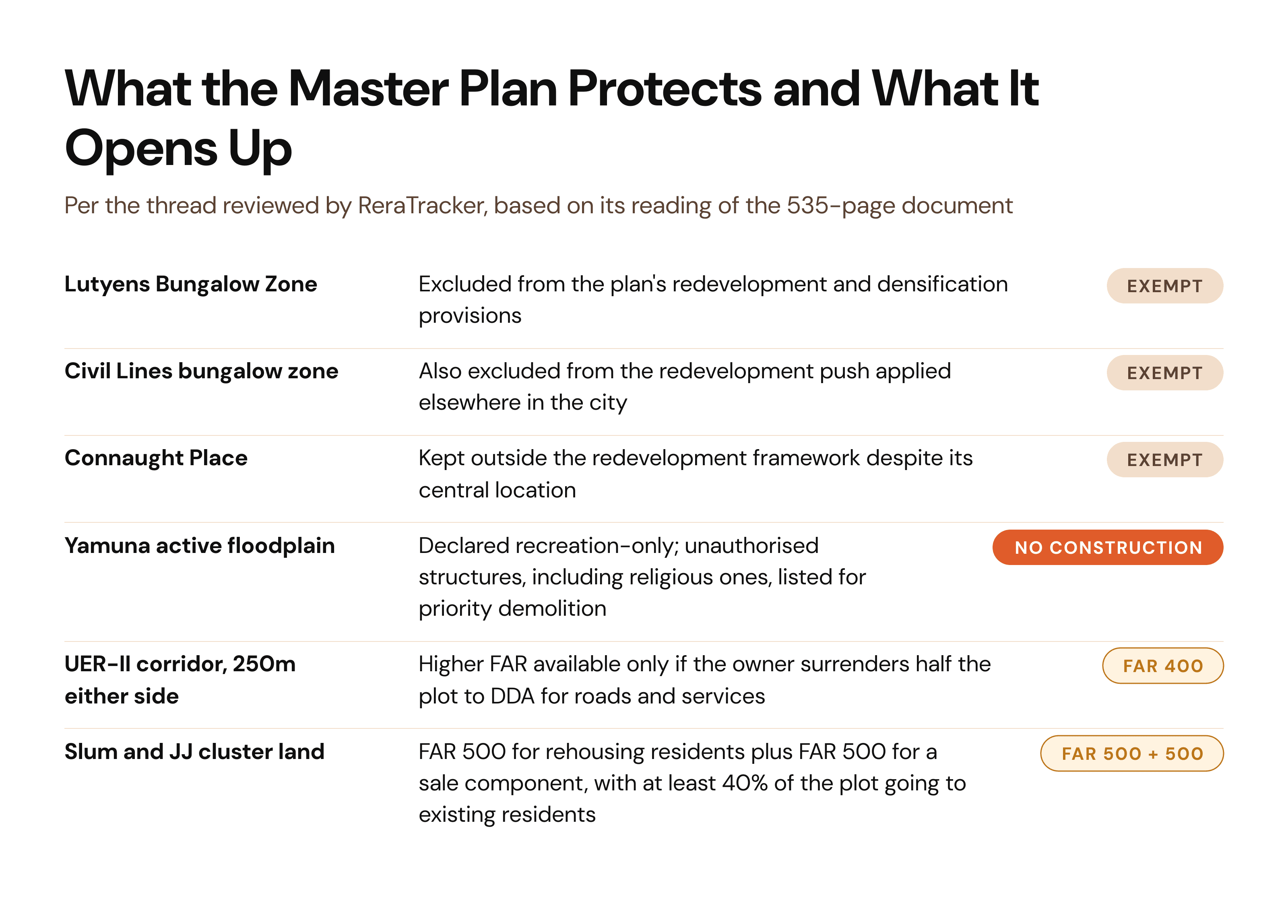
On a slum plot, a developer can build at FAR 500 for rehousing the residents, and another FAR 500 for flats they can sell. No height limit. No ground coverage limit.
At least 40% of the plot has to go to the residents. The rest is the developer's payment.
And if height rules stop them using all their sellable floor space, the unused portion becomes a transferable certificate they can carry to a Metro-side plot elsewhere and use there.
Slum land, converted into building rights, spendable somewhere else in the city.
Whether it works is a separate question. But the incentive is now real in a way it was not before.
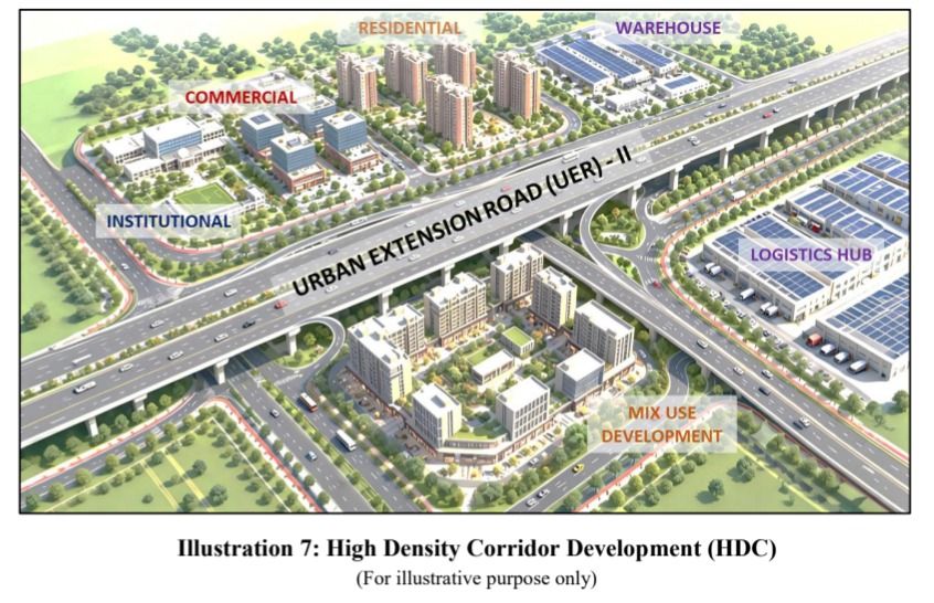
The UER-II corridor: higher FAR in exchange for land
There is a strip of land along a new highway called UER-II where the rules get more aggressive than anywhere else.
250 metres either side. Build at FAR 400, four times the normal residential allowance.
But there is a toll. You must hand over half your land to get it.
Own 8,000 sq metres, surrender 4,000, build at FAR 400 on what is left.
Do the maths and you end up with roughly the same floor space you would have had at FAR 200 on the full plot. What you gain is a properly built road network and services that DDA delivers on the surrendered land.
Whether that trade is worth it is the single biggest argument happening among landowners on that corridor right now.
Builder floors and farmhouses: what most individual plot owners actually get
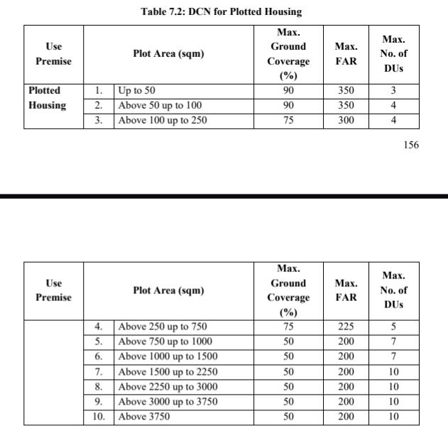
If you own a plot in Delhi and want to know exactly what you can build on it, this is the table.
The one table that governs every builder floor in South and West Delhi.
| Plot size | Ground coverage | FAR | Homes |
|---|---|---|---|
| Up to 100 sq m | 90% | 350 | 4 homes |
| 100 to 250 sq m | 75% | 300 | 4 homes |
| 250 to 750 sq m | 75% | 225 | 5 homes |
| 750 to 1,500 sq m | 50% | 200 | 7 homes |
| Above 1,500 sq m | 50% | 200 | Up to 10 homes |
Height 15 metres, or 17.5 metres with stilt parking.
Large plots now carry far more units than the four floor formula assumes.
On the Farmhouses:
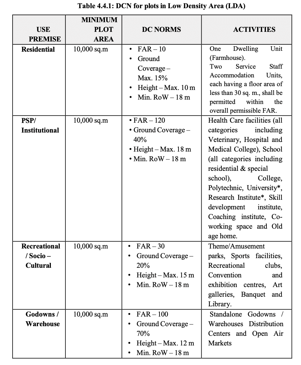
| Parameter | Norm |
|---|---|
| Minimum plot | 10,000 sq mt (about 2.47 acre) |
| FAR | 10 |
| Ground coverage | Maximum 15% |
| Height | Maximum 10 metres |
| Homes permitted | One Farmhouse + 2 small staff accommodation units |
So the minimum farmhouse plot is now about 2.47 acres.
Everywhere else in Delhi the plan is screaming build more. Here it says the opposite.
Land pooling on Delhi's edges
And now about land pooling, and it works like this...
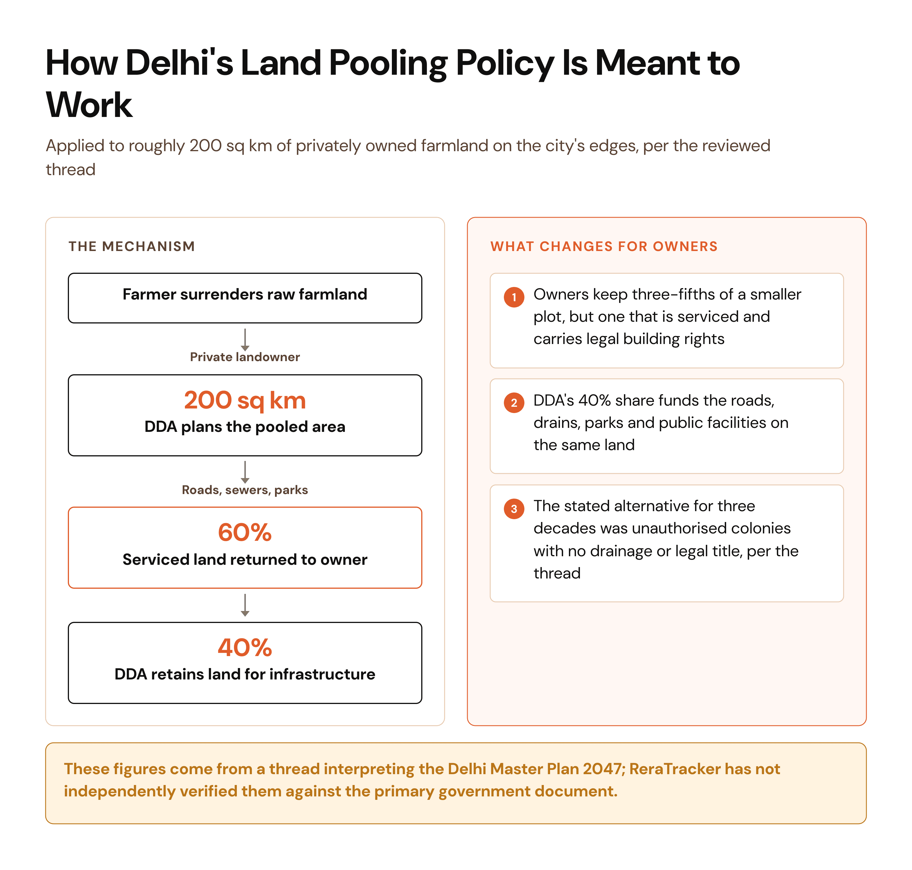
The plan does something unusual with 200 sq km of privately owned farmland on the edges of Delhi.
Farmers hand their land to a scheme. It gets planned properly, with roads and sewers and parks, as one piece instead of a hundred fragments.
Then the land comes back split. Owners keep 60%, DDA keeps 40%. DDA uses its share for the roads, drains, parks and public facilities.
You give up 40% of your land and what you keep is worth far more, because it now has a road, a sewer and legal building rights.
The alternative, which is what happened for the last thirty years, is that the same land turns into an unauthorised colony with no drainage and no legal title.
Mandatory small flats in group housing
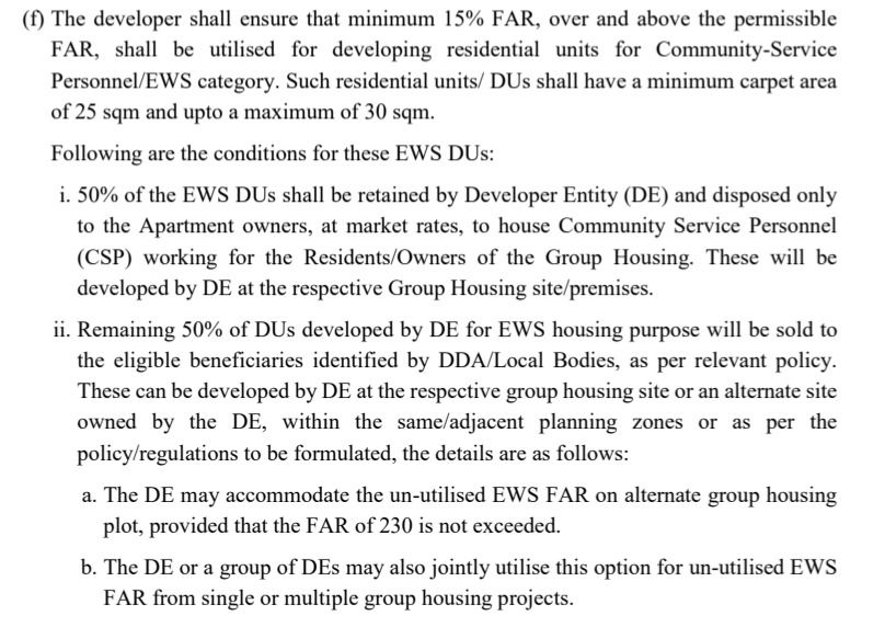
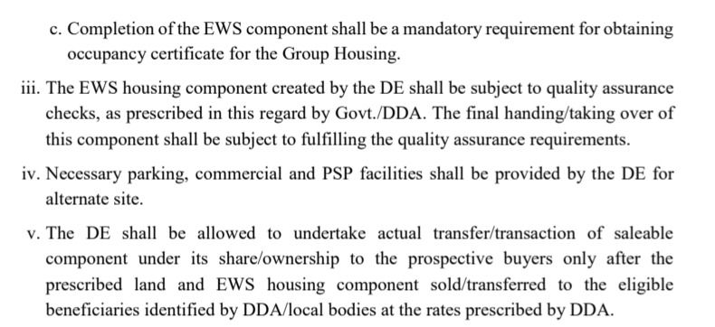
There is a rule for builders that reads like a small print detail: No occupancy certificate until the small flats are finished.
Any group housing project must build an extra 15% of floor space, over and above what it is otherwise allowed, as small flats of 25 to 30 sq metres.
Half of those, the builder sells to the flat owners at market rate, meant for domestic staff and drivers.
The other half goes to people the government identifies.
And the enforcement is the clever bit. The builder cannot get an occupancy certificate until those flats are finished. No occupancy certificate means nobody can legally move into the main towers.
You cannot hand over the luxury flats until the small ones are built. That is the whole mechanism, in one sentence.
The Yamuna floodplain: no construction, and a demolition list
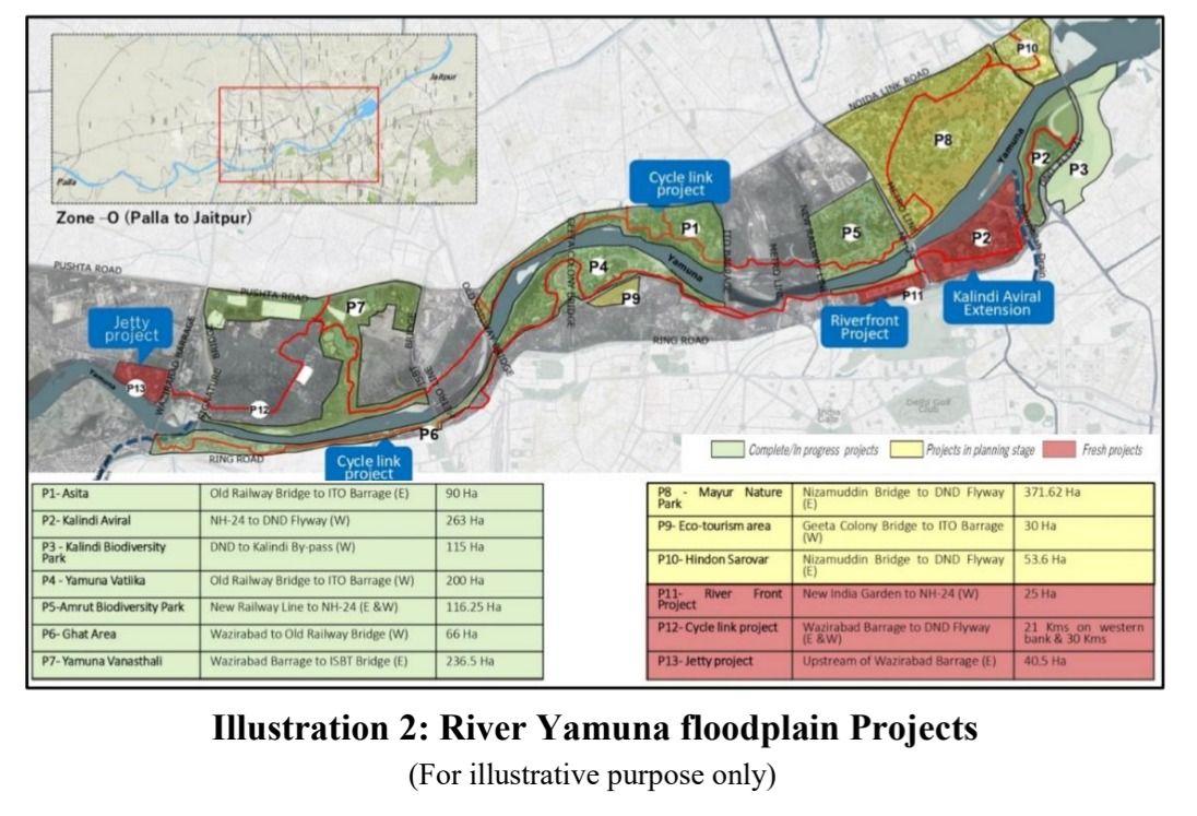
The Yamuna: The active floodplain is declared a no construction zone. Recreational use only.
All unauthorised structures on it, and the plan specifically names religious ones, are to be demolished on priority.
And the river is excluded from every single growth policy in the document. No Metro FAR, no land pooling, no redevelopment. Nothing.
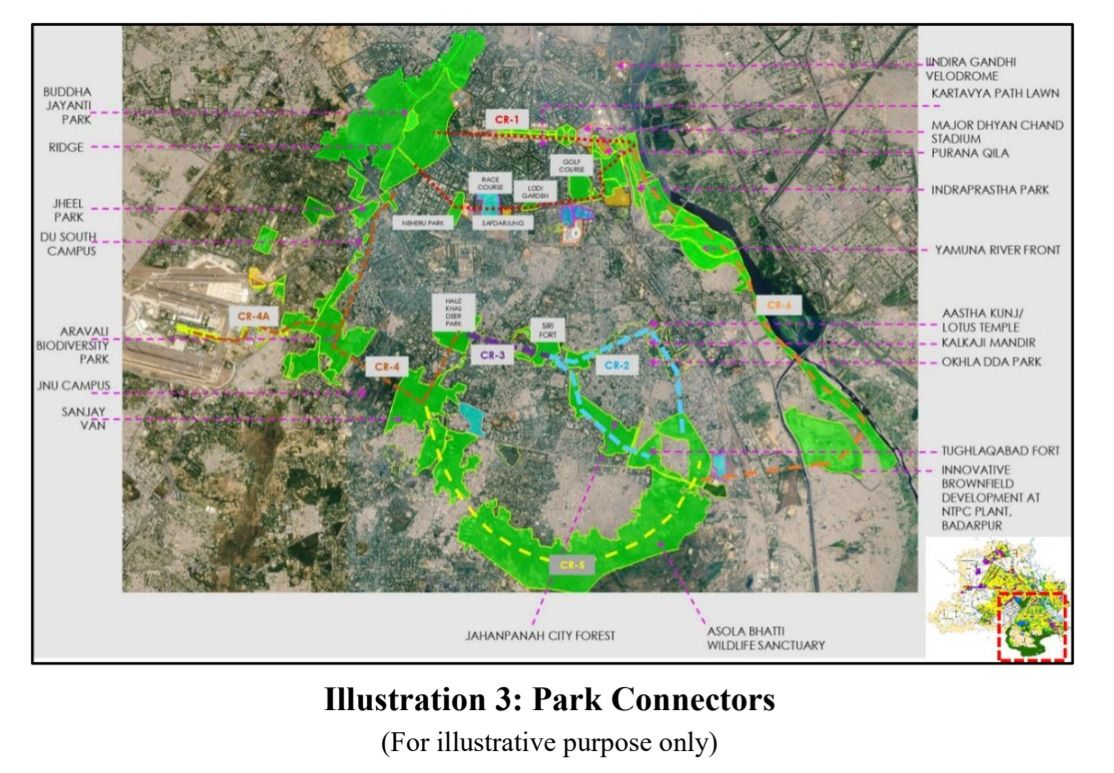
What is planned instead: restoring 22 km of river between Wazirabad and Okhla, 13 projects across 1,700 hectares, a 200 km cycling network with 52 km running along the floodplain, and a 75 to 100 metre wide public greenway on the embankments.
What the plan leaves untouched
Now look at what the plan does not touch.
- Lutyens Bungalow Zone: exempt from everything
- Civil Lines bungalows: exempt
- Connaught Place: exempt from redevelopment
These are the most valuable few square kilometres in India. Enormous plots, colonial bungalows, a handful of occupants each. In a city being told it must densify because there is no land left, the emptiest land is the only land that is protected.
There are heritage and diplomatic reasons for this. There have always been heritage and diplomatic reasons for this.
Also in the same section: no new mixed use or commercial streets will be notified for the entire 21 year period. If your street is not already on the list of 2,183, it never will be. If it is, that just became a permanent advantage.
What buyers and investors should verify before acting
- Confirm the plot's actual zone classification (Metro Transit Corridor, general residential, farmhouse, heritage-protected or slum-redevelopment land) with the Delhi Development Authority directly, rather than assuming a higher FAR applies because a property is described as being "near a metro station."
- On Metro-zone purchases, ask what share of the project's saleable area is legally reserved for units under 60 sq m before treating the entire inventory as freely marketable.
- On a DDA or CGHS redevelopment pitch, check whether the society has crossed the stated 3,000 sq m minimum plot threshold and whether RWA consent and formal notification actually exist, since the thread itself says detailed regulations follow only after notification.
- On a UER-II corridor plot, get an independent estimate of net saleable area after the 50% land-surrender condition rather than relying on the headline FAR 400 figure alone.
- On land-pooling parcels, confirm in writing which scheme applies, what the actual owner-authority split is for that specific parcel, and whether servicing has been completed rather than only planned.
- On a slum-redevelopment or transferable-rights-based purchase, ask how any transferable development certificate is valued and where it can legally be used before treating it as cash-equivalent.
- Remember that a policy provision is not a completed transaction. None of the FAR increases, redevelopment rights or exemptions described here amount to a guarantee of project approval, construction quality or delivery timeline for any specific property.
About ReraTracker
ReraTracker is an independent research platform that tracks project registrations, developer track records, pricing history and regulatory filings across Delhi-NCR markets, including Gurugram, Noida, Greater Noida, Ghaziabad and Sohna. The platform is built for buyers, investors and channel partners who want to verify claims against the underlying record rather than rely solely on developer or broker representations.
This article is based on a direct reading of the "Master Plan for Delhi – 2047" document compiled and printed by DDA. For information only, not legal or investment advice — verify current status on dda.gov.in before acting on any provision described here. Nothing in this article constitutes legal, tax or investment advice.